Nearest Town
Chamonix
Altitude
1167m
Capacity
Memorial
Accommodation
Phone
PhoneNumber
Website
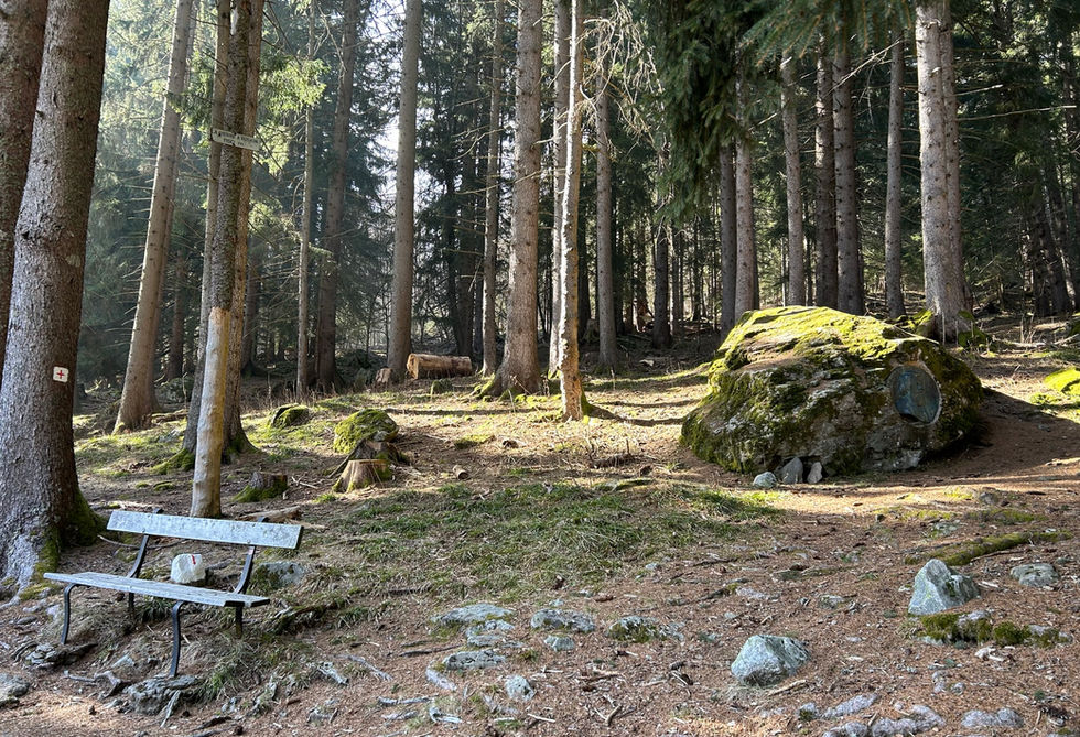
The Piere a Ruskin is a beautiful bronze medallion etched into a big rock near the bottom of the Brevent lift near the center of Chamonix. There is road leading up to the monument that bares the same name: Chemin de la Pierre a Ruskin. From there you will climb up and look for a trail that leads to the left. You will first pass by a marker for another nearby monument, the Genevieve Bouvier memorial site. Pass this by and the next trail to your left will have a a trail marker indicating the Piere a Ruskin. The stone and bronze plaque itself are not directly along the trail. You will notice a bench and then you have to move to the right into the forest and that is where you will see the rock and the plaque. Our trail to Merlet from Chamonix passes by the Piere a Ruskin.
The bronze plaque was created by sculptor Michel de Tarnowsky and the monument was officiated on July 19, 1925. This website has a lot more information on John Ruskin and the story of the monument. In short, John Ruskin was a writer and painter who spent a lot evenings admiring the views of the mountains from his rock below Brevent. This rock become known the locals at the time as the 'Pierre a Ruskin' or the stone of Ruskin.
Pierre a Ruskin Photos
Below are all the photos we have in our Chamonix Photos collection for this point of interest. All our photos are tagged with the GPS coordinates and linked to the trails that you can take to find the location where the photo was taken. So if you want to see the full details for a specific photo then just click on it.
Hiking & Running Trails to Pierre a Ruskin
All the trails and points of interest around Chamonix on our website are linked to each other so you can easily pick trails that cover the things you would like to see or visit sights that are nearby and can easily be combined with your target destination. These are the hiking and trail running trails and points of interest linked to Pierre a Ruskin
Points of Interests near Pierre a Ruskin
Where is Pierre a Ruskin?
Latitude:
45.9247
Longitude:
6.86028
Below you will find the location of Pierre a Ruskin on the map. You can also click the button to show the nearby trails and points of interests that are listed above on the same map. Another option is to visit our interactive map that shows Pierre a Ruskin and everything else that is listed on our website.
Looking for more Statues and Monuments?
Pierre a Ruskin is only one of many monuments and statues around Chamonix. We got many more we would love to show you and many more you should visit! To view all the other monuments and statues we cover on our website, you can visit our Monuments and Statues around Chamonix page or view all the monuments and statues around Chamonix on our interactive map
Looking for other sights, attractions and points of interest around Chamonix?


