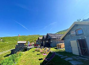
The Refuge Col de Balme is a popular refuge located on the Col de Balme above Le Tour on the far north-eastern end of the Chamonix Valley. It lies on the border with Switzerland. The nearby summit of Tete de Balme has a stone border marker.
The refuge offers dormitory style accommodation which means they will provide beddings but you need to bring your own sleeping bag liner which is the standard for most mountain refuges. When they are open, the refuge doubles as a snack bar offering snacks and drinks. The Refuge is open from early June to mid September. You should check their own website for the exact dates and to find more booking information including a link to an offsite online booking form.
The easiest access to the Refuge Col de Balme is using the Autannes chair lift which connects to the Charamillon gondola which departs from the hamlet of Le Tour. From the Autannes chair lift its a short straight traverse to the refuge.
Refuge Col de Balme Photos
Below are all the photos we have in our Chamonix Photos collection for this point of interest. All our photos are tagged with the GPS coordinates and linked to the trails that you can take to find the location where the photo was taken. So if you want to see the full details for a specific photo then just click on it.
Hiking & Running Trails to Refuge Col de Balme
All the trails and points of interest around Chamonix on our website are linked to each other so you can easily pick trails that cover the things you would like to see or visit sights that are nearby and can easily be combined with your target destination. These are the hiking and trail running trails and points of interest linked to Refuge Col de Balme
Points of Interests near Refuge Col de Balme
Where is Refuge Col de Balme?
Latitude:
46.0267
Longitude:
6.9701
Below you will find the location of Refuge Col de Balme on the map. You can also click the button to show the nearby trails and points of interests that are listed above on the same map. Another option is to visit our interactive map that shows Refuge Col de Balme and everything else that is listed on our website.
Looking for more Refuges?
Refuge Col de Balme is only one of many refuges around Chamonix. We got many more we would love to show you and many more you should visit! To view all the other refuges and mountain accommodations we cover on our website, you can visit our Refuges around Chamonix page or view all the mountain accommodations around Chamonix on our interactive map
Looking for other sights, attractions and points of interest around Chamonix?


