Nearest Town
Sallanches
Altitude
1495m
Capacity
Chapel
Accommodation
Phone
PhoneNumber
Website
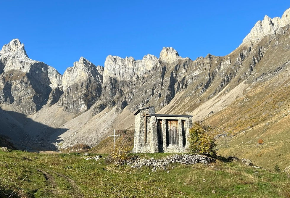
The Chapelle Notre Dame de la Paix du Monde is located right next to the Chalets de Doran below the Chaine des Aravis on the Sallanches side. It is located on the left side of the main trail towards the Chalets de Doran if you are coming up to the chalets from the Sallanches side.
The chapel was originally built by Louis Faurobertin who started the idea in 1949 after realizing that the shepherds and farmers working the pastures around Doran had no place of worship and had to make the strenuous journey to visit the church in Sallanches. Work started in 1950 and was completed in 1957. Remarkably enough the work was performed by more than 1,500 truck drivers from more than 15 different countries under the supervision of Louis Faurobertin. The chapel was inaugurated on August 5, 1957 by the Bishop of Annecy after being flown in by helicopter.
We got a detailed trail description for a loop trail that visits the Chalets de Doran and the Refuge de Tournieux. This trail passes by the chapel. We also have a longer, more challenging route that goes over the Col de la Forclaz towards the Tete de Chateau.
Chapelle Notre Dame de la Paix Photos
Below are all the photos we have in our Chamonix Photos collection for this point of interest. All our photos are tagged with the GPS coordinates and linked to the trails that you can take to find the location where the photo was taken. So if you want to see the full details for a specific photo then just click on it.
Hiking & Running Trails to Chapelle Notre Dame de la Paix
All the trails and points of interest around Chamonix on our website are linked to each other so you can easily pick trails that cover the things you would like to see or visit sights that are nearby and can easily be combined with your target destination. These are the hiking and trail running trails and points of interest linked to Chapelle Notre Dame de la Paix
Points of Interests near Chapelle Notre Dame de la Paix
Where is Chapelle Notre Dame de la Paix?
Latitude:
45.96827
Longitude:
6.58835
Below you will find the location of Chapelle Notre Dame de la Paix on the map. You can also click the button to show the nearby trails and points of interests that are listed above on the same map. Another option is to visit our interactive map that shows Chapelle Notre Dame de la Paix and everything else that is listed on our website.
Looking for more Churches and Chapels?
Chapelle Notre Dame de la Paix is only one of many churches and chapels around Chamonix. We got many more we would love to show you and many more you should visit! To view all the other churches and chapels we cover on our website, you can visit our Churches and Chapels around Chamonix page or view all the churches and chapels around Chamonix on our interactive map
Looking for other sights, attractions and points of interest around Chamonix?


