Length
14.98km

Elevation + / -
1561m / 1561m

Altitude Range
1051m / 2589m

When to go
Start Jul - Start Oct
Hike duration
7.0 - 9.0 Hours

Run duration
3.0 - 5.0 Hours

Technical level
Difficult

Natural beauty
Incredible

Families
12+ Years old

Dogs
Dogs Allowed

Provision Sources
2 Snack Bars

Trail type
Out and Back
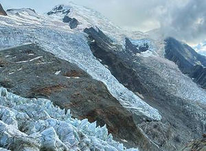
A well-known classic route often recommended as a day hike for people that want to get up close to the glaciers and have amazing views of Mont Blanc. It is quite a strenuous hike but at the end you will be rewarded with a fantastic view at La Jonction where the Glacier de Bosson and Glacier de Taconnaz come together. You can shorten the trip a little bit by using the Glacier des Bossons lift which takes you straight to the first snack bar: Chalet du Glacier des Bossons. The lift is typically open from mid June to mid September. There is a second snack bar called the Chalet des Pyramides further up the trail giving you another option for a snack or a drink. After reaching the Jonction you will use the same trail to go back. That is maybe the only down side of this famous trail.
Video of this Trail
We have made a video presentation for this trail. The video will provide full 3D fly over of the route and then give a great overview of the experience you can expect when you take on this trail. It is a great way to quickly understand if this is the perfect trail for you. Please visit our channel on YouTube and like the video and subscribe to our channel. Putting together these videos is a lot of work!
Photos of this Trail
Below are all the photos we have in our Chamonix Photos collection for this point of interest. All our photos are tagged with the GPS coordinates and linked to the trails that you can take to find the location where the photo was taken. So if you want to see the full details for a specific photo then just click on it.
Trail Directions & Safety Considerations

Risk Considerations & Difficulty Assessment
La Jonction ends at an altitude of 2589m and its orientation is such that the snow melts quite late in the season. Therefor this route is generally recommended from early July to early October. Always check for the conditions before heading out. The trails are very well marked. In the beginning using trail markers and later on as you reach the end with painted dots on the rocks. There is generally only one way up and down so no danger of getting lost. The trail itself is not difficult until you reach the final bit. The end part is very rocky and could be slippery when wet. Some big steps and hand grabs will be needed.

Children
12+ Years old

Dogs
Technically possible but its a long way up and quite technical.

Trail Directions
On the left side of the Les Glaciers des Bossons you will find a trail marker indicating La Jonction. This path will take you up to the first snack bar on this route: the Chalet du Glacier des Bossons. If the lift is operational you can also skip this first part of the hike by using the lift. You will not miss much and the lift ride is worth it. At the Chalet du Glacier des Bossons and thereafter there will be very clear signs for La Jonction so just keep following there. There are no other trails in other directions so getting lost is virtually impossible. After a number of switchbacks in the forest you will reach the second snack bar on this route: the Chalets des Pyramides. After this rest stop you will snake your up and the forest will turn into rocky paths. The views of Mont Blanc will get better and better. You will start noticing that the path gets rockier and that instead of signs you will have painted dots on the rocks to guide you. Assuming you are doing this without snow cover you should have no problem navigating your way up to the end point: La Jonction. After enjoying the view you can head back the same way. On your way down you will notice a sign that says "Sans Issue". I have used this path in the past to use a different route to get back to the start. You should not use this route though. Its state is unclear and its clearly not maintained and not meant to be part of this route. You can find a photo of this split in the road in the pictures section.
Points of Interest
Our hiking and trail running trails around Chamonix are chosen for their natural beauty and variety. We also always try to combine as many sights, attractions and points of interests as possible in our trails. Below you will find a list of the points of interests linked to this trail.


