Paradis des Praz and Les Bois Loop
Our Rating
5
Average
Watch the Full Video on

Length
5.04km

Elevation + / -
72m / 72m

Altitude Range
1066m / 1105m

When to go
Mid Mar - End Nov
Hike duration
1.5 - 2.0 Hours

Run duration
30 - 40 Mins

Technical level
Very Easy

Natural beauty
Reasonable

Families
All ages

Dogs
Dogs Allowed

Provision Sources
2 Restaurants, 2 Snack Bars

Trail type
Loop
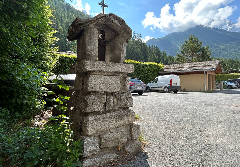
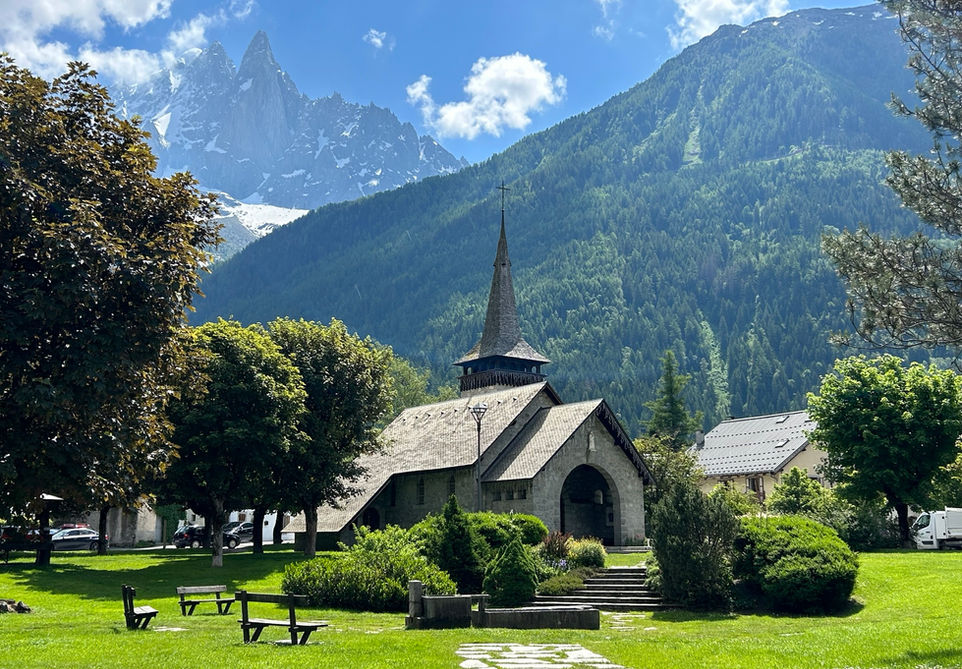
This is a nice family friendly walk on the valley floor making a loop between Les Praz and Les Tines and visiting all the points of interest in between. We start this trail at the parking of the Chamonix Golf Club in Les Praz. From there we go to the large playground and snackbar at Le Paradis des Praz. Kids will have a great time here and the snack bar serves drinks, ice cream, waffles and pancakes. From there we walk along the Arve river towards Les Tines. This is a wonderful trail with a beautiful little river and a couple of areas where you can sit down and let the kids do their thing. We take the second bridge at Les Tines which brings us to the very nice Chapelle Saint-Theodule. From there we pass a small oratory before crossing the main road and heading into the forest. We then make our way to Les Bois and pass by the Hotel La Prairie. They got a very nice open outdoor sitting area and they also serve light meals and snacks. We then pass by the another small oratory before making our way to Les Praz. The Chapelle des Praz and the open manicured gardens around it are very pictoresque. From there it is a short walk back to the car park at the golf club. This trail is easy to combine with a sit down lunch or dinner at either Le Castel right next to the Chapelle des Praz or La Cabane des Praz right next to the Golf course club house.
All in all a very nice family friendly walk which showcases one of the nicest areas of the Chamonix Valley. This is one of the easiest walks we have on our website in terms of length and vertical gain. Young kids should be able to join and the trail is stroller friendly as long as your stroller has larger or wider wheels.
Video of this Trail
We have made a video presentation for this trail. The video will provide full 3D fly over of the route and then give a great overview of the experience you can expect when you take on this trail. It is a great way to quickly understand if this is the perfect trail for you. Please visit our channel on YouTube and like the video and subscribe to our channel. Putting together these videos is a lot of work!
Photos of this Trail
Below are all the photos we have in our Chamonix Photos collection for this point of interest. All our photos are tagged with the GPS coordinates and linked to the trails that you can take to find the location where the photo was taken. So if you want to see the full details for a specific photo then just click on it.
Trail Directions & Safety Considerations

Risk Considerations & Difficulty Assessment
This trail stays on the valley floor and at the highest points it reaches an altitude of 1105 meters. The trail should be accessible even in winter as these are popular trails year round. The trails themselves are the easiest you will find in Chamonix. Forest paths and paved roads all the way. Navigating the trail is easy and a wrong turn will never be too punishing.

Children
All ages

Dogs
We recommend to keep your dog on a leash

Trail Starting Point
We start the trail at the parking of the Chamonix Golf Course. This is a good option if you are coming by car. Another good option is to park your car at the Flegere lift station or the annex parking across from the Le Castel hotel and restaurant in the center of Les Praz. If you are coming with public transport then the Les Praz train station drops you very close to the trail we are following. You can also take the bus to the Flegere lift station.

Trail Directions
We start at the parking at the Chamonix Golf Club. Walk to the northern end of the parking and it will turn into a 4x4 track that leads to the driving range. At the driving range, turn left and cross the bridge. Stay on the trail and it will lead you to an opening at the Paradis des Praz. From there continue on the flat trail that runs next to the river. Keep going past the first bridge over the river and take the second bridge. You are now in the hamlet of Les Tines. Keep going till the end of the road and a junction that has a water fountain at it. You will see a trail marker for the Chapelle Saint Theodule. Turn left and visit the chapel. Afterwards turn back to where you came from and now keep heading in a southern-direction till you hit the D2105 main road. There is a pedestrian crossing near the bus stop. Cross the road and enter the wide 4x4 track leading into the forest going slightly uphill. At the first junction, turn right towards Les Bois. Keep going straight and at the junction in the forest keep right. Keep heading in the same direction and the trail will turn into a paved road as you enter Les Bois. Keep going and on the right side you will see the Hotel La Prairie. This is an excellent spot for a break to enjoy the open views. Afterwards, keep going in the same southern direction till you hit the junction with the Avenue des Bois. Keep going straight. At the next junction you will make a right, turning into the Chemin de la Plaine. You can quickly take a super short detour to visit the Oratoire des Bois which is right around the corner of the junction. Turn back and take the Chemin de la Plaine all the way to the road that runs parallel to the train track. Follow that road southwards till you hit a big junction where you can cross the rail track and you will see the big round about at Les Praz and the Chapelle des Praz. Cross the grass field at the Chapel and at the bus stop turn right and head in a northern direction. Now simply walk on the sidewalk next to the main road until you reach the golf course at the La Cabane restaurant.
Points of Interest
Our hiking and trail running trails around Chamonix are chosen for their natural beauty and variety. We also always try to combine as many sights, attractions and points of interests as possible in our trails. Below you will find a list of the points of interests linked to this trail.


