Length
5.5km

Elevation + / -
298m / 298m

Altitude Range
1043m / 1350m

When to go
Start Apr - End Oct
Hike duration
75 - 100 Mins

Run duration
40 - 60 Mins

Technical level
Easy

Natural beauty
Nice

Families
7+ Years old

Dogs
Dogs Allowed

Provision Sources
1 Snack Bar

Trail type
Out and Back
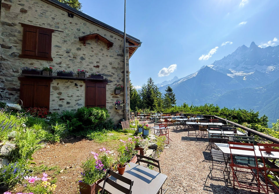
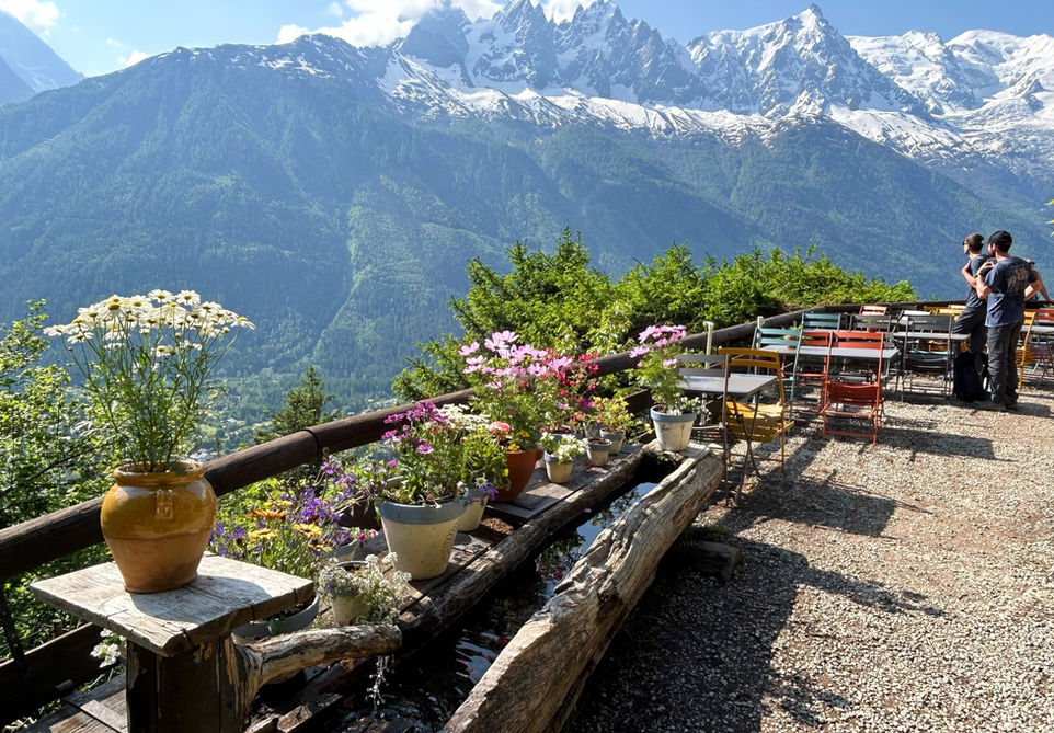
This little trails takes you from Chamonix to the Chalet de la Floria, a nice snack bar perched above Les Praz and the Chamonix golf course with nice views over the valley and the Mont Blanc Massif. The proprietor of the Chalet always do a great job each spring and summer to put beautiful flowers all over the chalet and they have a nice viewing deck where you can sit and enjoy a snack and a drink. The walk is child and dog friendly but it does require quite a bit of uphill climbing to reach the chalet. The trail we are presenting here is a simple walk up to the Chalet la Floria and then you take the same route back. There are many alternative routes you can take. You can include it as part of the Petite Balcon Sud (PBS) by taking the route up to La Floria and then descend back into the PBS. Another good option is to take the Gondola up to Flegere and then walk back to Chamonix via La Floria.
Video of this Trail
We have made a video presentation for this trail. The video will provide full 3D fly over of the route and then give a great overview of the experience you can expect when you take on this trail. It is a great way to quickly understand if this is the perfect trail for you. Please visit our channel on YouTube and like the video and subscribe to our channel. Putting together these videos is a lot of work!
Photos of this Trail
Below are all the photos we have in our Chamonix Photos collection for this point of interest. All our photos are tagged with the GPS coordinates and linked to the trails that you can take to find the location where the photo was taken. So if you want to see the full details for a specific photo then just click on it.
Trail Directions & Safety Considerations

Risk Considerations & Difficulty Assessment
Chalet la Floria sits at an altitude of 1350m. The Chalet itself is typically open from the end of May till the end of October. They will be open some weekends and holidays in between. The trail is generally accessible from April till late October and possible earlier and later depending on the snow fall. The trail is well marked and easy to follow. The trail itself is mostly a 4x4 track used by the proprietors of the Chalet for supplies. At the very start the trail is quite steep but its not technical.

Children
7+ Years old

Dogs
We recommend to keep your dog on a leash

Trail Starting Point
You can start the trail at the Parking des Tennis in Chamonix and our GPX file and route map show this as the starting and end point. In reality you can start this from anywhere in Chamonix of course and there are many other trails that you can take to reach the Petit Balcon Sud and then you can add a visit to La Floria as a detour.

Trail Directions
Start at the entrance of the Tennis Parking lot. Right across the street you will see a trail that zigzags up the hill. Take this trail until you reach the Route des Nants. Cross the road and you will see a little path going up to the left. Take this path and at the end of it take a right and you will see the trail marker for La Floria. Follow this trail and keep going up the hill. There will be frequent trail markers and you cannot miss the Chalet de la Floria. Take the same trail back to the start.
Points of Interest
Our hiking and trail running trails around Chamonix are chosen for their natural beauty and variety. We also always try to combine as many sights, attractions and points of interests as possible in our trails. Below you will find a list of the points of interests linked to this trail.


