Length
9.6km

Elevation + / -
486m / 507m

Altitude Range
1903m / 2237m

When to go
Start Jul - End Sep
Hike duration
3.0 - 4.0 Hours

Run duration
60 - 90 Mins

Technical level
Moderate

Natural beauty
Very Nice

Families
7+ Years old

Dogs
Dogs Allowed

Provision Sources
2 Restaurants

Trail type
Loop
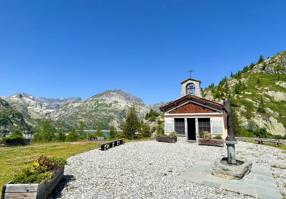
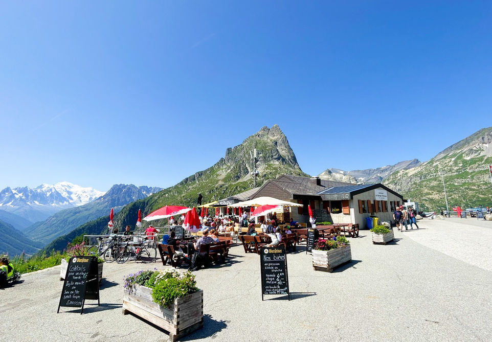
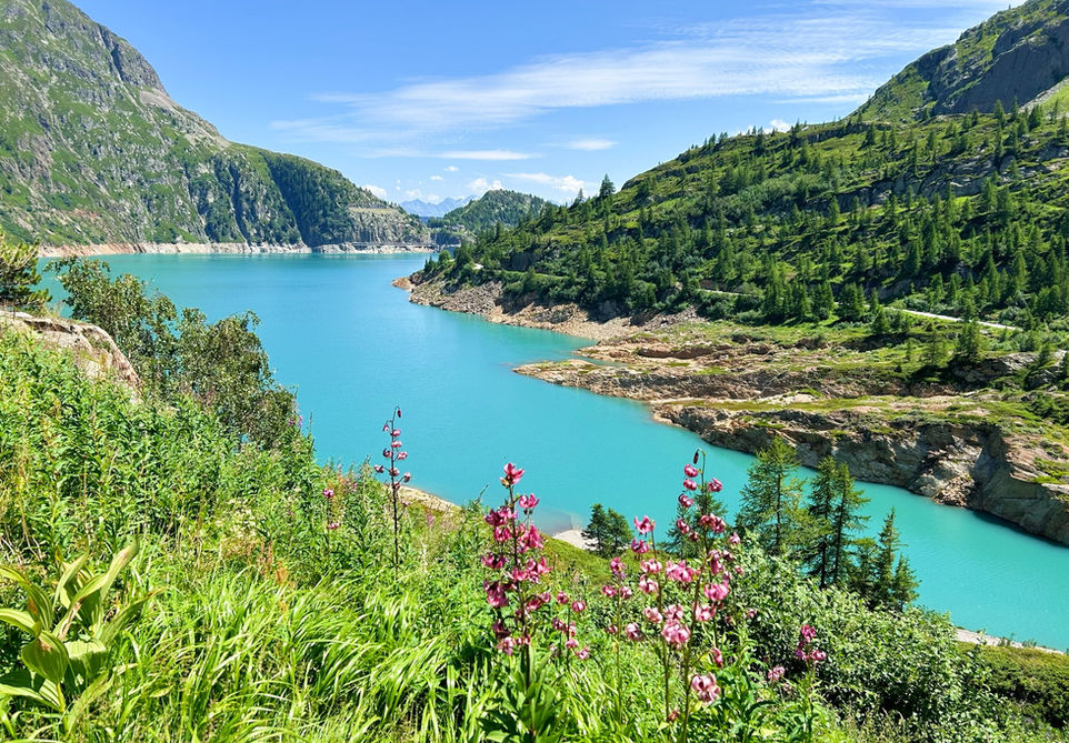
The Lac d'Emosson lake is the largest lake in the area. The lake is formed by the very large and impressive Emosson dam. The views from the dam over the lake and on the other side towards the valley below and across towards Mont Blanc are pretty spectacular. This trail starts at the Emosson Dam where you will also find the Chapelle de Notre Dame de la Neige and the large Restaurant du Barrage de Emosson. We then walk over the full length of the dam and go uphil and inland over a crest until we reach the Vieux Barrage de Emosson and the Lac du Vieux Emosson. This is the original dam and lake built in 1955. It lies at an altitude of 400 meters above the bigger dam and lake and provides great views. There is also a restaurant here called the Cabane de Vieux Emosson where you can enjoy a meal or a snack before heading back. For the return we chose the paved road for an easy smooth way back to our starting point.
Note: for a spectacular way of starting your trail, you can choose to take the zipline that departs from behind the Restaurant du Barrage de Emosson. The zipline is pretty spectacular as it flies over the deep vally below the dam. If you have the nerves for it then this could be an excellent way to get things started!
Video of this Trail
We have made a video presentation for this trail. The video will provide full 3D fly over of the route and then give a great overview of the experience you can expect when you take on this trail. It is a great way to quickly understand if this is the perfect trail for you. Please visit our channel on YouTube and like the video and subscribe to our channel. Putting together these videos is a lot of work!
Photos of this Trail
Below are all the photos we have in our Chamonix Photos collection for this point of interest. All our photos are tagged with the GPS coordinates and linked to the trails that you can take to find the location where the photo was taken. So if you want to see the full details for a specific photo then just click on it.
Trail Directions & Safety Considerations

Risk Considerations & Difficulty Assessment
The trail reaches an altitude of 2237 meters. The trail going up to the Cabane de Vieux Emosson is likely to have some snow cover till early to the middle of July. The trail is very easy to follow seeing how you can see your end destination, the old Emosson dam, from a distance for a majority of the trail. Vieux Emosson is well marked by multiple trail markers. The trail takes place on the paved road for a large part. The trail between the paved road and reaching the cabine is quite technical with a large number of metal chains and big rocks. You are likely to use your hands quite a bit on those sections.

Children
7+ Years old

Dogs
We recommend to keep your dog on a leash

Trail Starting Point
The trail starts at the Chapelle du Notre Dame de la Neige near the Emosson Dam parking. If you are coming by car then you can drive all the way up to Emosson using the main road coming from Finhaut. From Chamonix this is roughly a 40 minute drive. You can also park at Le Chatelard and take the Verticalp furnicular and train from there. In our experience, the number of parking slots there is so limited that during the peak season we were never able to park our car there. If you are coming by public transport, then your best option is to take the train to Vallorcine and from there take the Swiss train to Martigny. Get off at Le Chatelard and grab the VerticAlp furnicular from there. It might sound like hassle, but both the train and furnicular offer good scenery and are very nice.

Trail Directions
We start the trail at the Chapelle de Notre Dame de la Neige. This chapel is located on an elevated position above the big open area where the Restaurant du Barrage de Vieux Emosson is located. If you are coming from the direction of the large carpark then you will see a paved road on your left heading up a slope. Follow this for about 100 meters and you will reach the chapel. From the chapel we walk do down passed the restaurant. If you are adventurous you can take the zipline to make your way down to the far end of the dam. If this is too much adrenaline for you, then simply follow the path down the dam and walk across to the other side. Keep following the paved road that follows the lake until you see trail marker and a little trail on your left. The trail marker will say Vieux Emosson. You will climb steadily over a crest. Just keep following the signs for Vieux Emosson and you will easily reach the Cabane below the dam. You can climb up to the dam via the paved road which then turns into a trail a little further up. Once you are ready to head back simply go down until you are back on the paved road. We suggest you now just follow the paved road until it reaches the bigger dam again at the start of the trail. The views from the road are nice and there are a couple of tunnels cut out in the rock. If you prefer you could also take the exact same trail that you used for reaching the Vieux Emosson dam.
Points of Interest
Our hiking and trail running trails around Chamonix are chosen for their natural beauty and variety. We also always try to combine as many sights, attractions and points of interests as possible in our trails. Below you will find a list of the points of interests linked to this trail.


