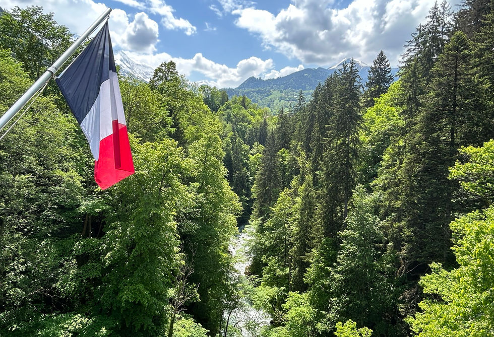
Saint-Gervais-les-Bains is a town located west from Chamonix at the start of the Montjoie valley. It has a population of roughly 5,000 inhabitants. It is a popular tourist destination for both summer and winter mountain activities but it does not draw in the same crowds as the main towns in the Chamonix valley. It has fantastic tourist infrastructure with plenty of hotels, restaurants, bakeries and attractions to accommodate and entertain guests. The beautiful Église Saint-Gervais-et-Saint-Protais is the main church in the center of town and it is worth a visit. The Pont du Diable is a big bridge over a deep gorge through which the Bonnant river flows. There are flags of many nations mounted on the bridge and the views from the bridge are pretty nice.
Saint-Gervais is easily reached by public transport with the Saint-Gervais-les-Bains-le-Fayet train station being the starting point for the train that runs passed Servoz, across the entire Chamonix Valley and ends in Vallorcine. The very popular Tramway du Mont Blanc mountain train also starts near the Le Fayet train station and ends up at the Nid d'Aigle at more than 2400 meters. Another popular attraction in Saint-Gervais, is the Parc Thermal du Fayet which has a rock climbing wall, accro park, playgrounds and a thermal bath and treatment center.
The westward ski runs of Les Houches end right above Saint Gervais but the town has no lifts servicing that ski area. Instead Saint Gervais has lifts that connect it to the very large ski area of Megeve. The Betex lift is open in summer and a great way of exploring Mont Joly
Saint-Gervais-les-Bains Photos
Below are all the photos we have in our Chamonix Photos collection for this point of interest. All our photos are tagged with the GPS coordinates and linked to the trails that you can take to find the location where the photo was taken. So if you want to see the full details for a specific photo then just click on it.
Hiking & Running Trails to Saint-Gervais-les-Bains
All the trails and points of interest around Chamonix on our website are linked to each other so you can easily pick trails that cover the things you would like to see or visit sights that are nearby and can easily be combined with your target destination. These are the hiking and trail running trails and points of interest linked to Saint-Gervais-les-Bains
Points of Interests near Saint-Gervais-les-Bains
Where is Saint-Gervais-les-Bains?
Latitude:
45.893
Longitude:
6.7114
Below you will find the location of Saint-Gervais-les-Bains on the map. You can also click the button to show the nearby trails and points of interests that are listed above on the same map. Another option is to visit our interactive map that shows Saint-Gervais-les-Bains and everything else that is listed on our website.
Looking for more Towns and Hamlets?
Saint-Gervais-les-Bains is only one of many towns, hamlets and villages around Chamonix. We got many more we would love to show you and many more you should visit! To view all the other towns, hamlets and villages we cover on our website, you can visit our Towns and Hamlets around Chamonix page or view all the villages and towns around Chamonix on our interactive map
Looking for other sights, attractions and points of interest around Chamonix?


